Maropea Forks Hut – Lake Colenso Hut – Kylie Biv (via Potae) , Yeomans Road end (via Upper Makarora Hut, Barlows Hut, Makarora River).
28 January to 31 January 2017
Alison suggested this tramp about a month earlier and as neither of us had been to these places before, it was on. It had been a while since I had been on a four-day tramp but I reckoned my fitness would be pretty good.
Saturday: We started at the Sunrise Hut car park, went up to the hut and on to Armstrong Saddle then down to Top Maropea Hut, which has been shifted and repiled. A Dingo digger must have been helicoptered in because there has been a fair amount of earth-moving.
From there, it was down an unnamed stream allowing about three hours to Maropea Forks Hut. The trip down the river was interesting with a number of streams coming in from the sides, nothing too deep and some nice pools along the way. About an hour from Maropea Forks Hut, I stepped down from the grassy river bank into a small pool and there was a lot of thrashing in the water. A rainbow trout shot out from my feet, heading downstream as fast as it could. I don’t know who got the biggest fright, me or the fish; amazing to find trout so far inland.

The relatively new Maropea Forks Hut.
We knew we were near to the hut when we saw a sign for Wakelings Hut and then a signpost pointing towards Maropea Forks Hut. It’s relatively new, about two years old and rebuilt by the army engineers unit. The old structure was under threat of being washed away. The hut is fully insulated with double glazing and insect screens on the windows, making it virtually soundproof. There are six bunks and a very good fire.
There were two hunters in residence, with their dog called Scout. I had a swim in the river, which was very cold.
It had taken just over three hours to come down the river, which was easy to navigate; the weather was very hot, and we had covered 20 kilometres.
Sunday dawned with hardly a cloud in the sky, so we were in for a warm one.
We had a good breakfast and headed across the river to the Unknown Campsite track (to Lake Colenso). What a start to the morning: the track climbed and climbed so we had our heart rate up early. There were great views as we got higher to look back at where we had come from the day before. Ruapehu and Ngauruhoe were just to the west of us, and so close.
After a few ups and downs, we reached the turn-off to Otukota Hut. From there to the Unknown Campsite, it was reasonably flat through original beech forest and fern. But the track had not been maintained for a number of years – lots of windfall trees to clamber over and the fern in places was five to six feet high. At least we were in the shade…
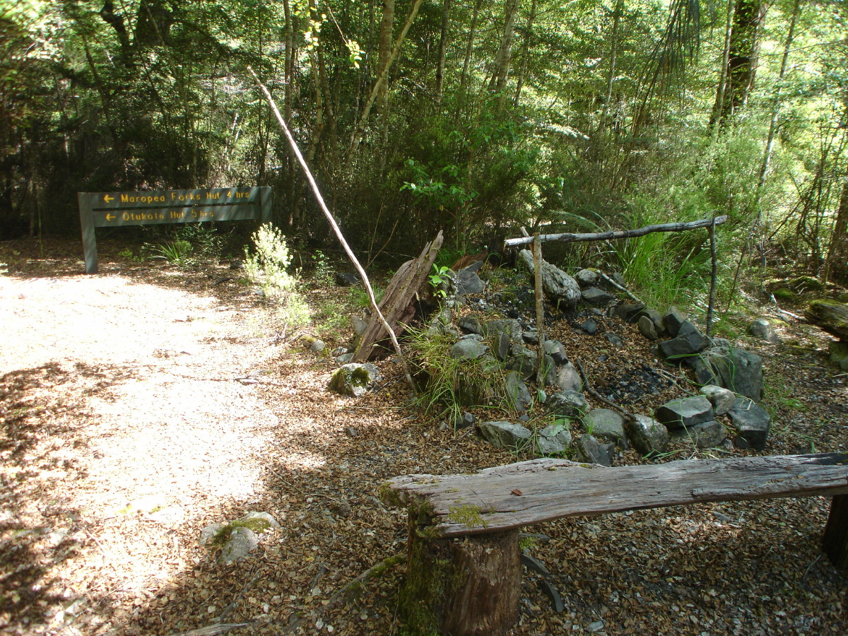
Unknown Campsite, and a good one too
After an early lunch and coffee, we looked across the river and could see a sign up a small creek. So we crossed, and the sign said Lake Colenso 1.5 hrs. (Our actual was three hours to the hut.)
We went up this creek for around 20 minutes and found a sign pointing us up a ridge; so we climbed, climbed and climbed some more, all in bush with no view anywhere. Eventually we worked out we were getting close to Colenso and not long after that we could look down on the lake in the distance; we were high up on a ridge and could work out where the hut is (not very close to the lake at all).
We followed this ridge down and man, it was so steep with not a lot to hang on to. You wouldn’t want to suffer from vertigo there. At the bottom of the ridge, we came to a sign that said Iron Bark Hut 5 hrs west and East Colenso Hut 1 hr. So it was not far now, and we were getting a bit tired. We made it there in 30 minutes.
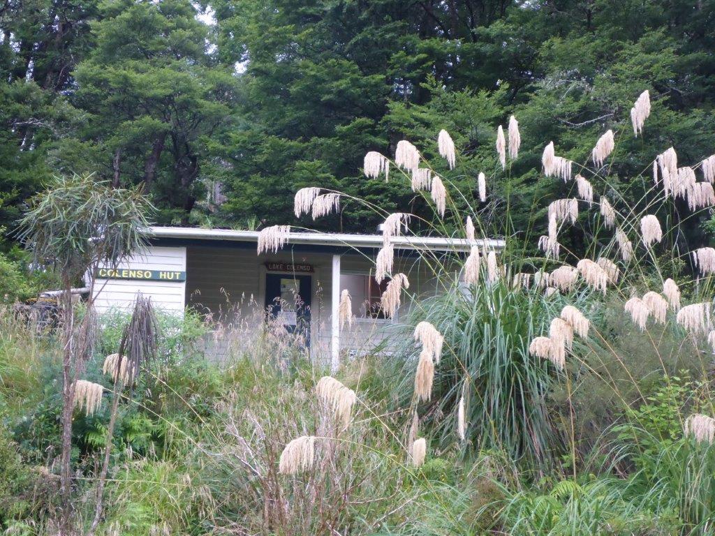
Colenso Hut, on the shelf above the river.
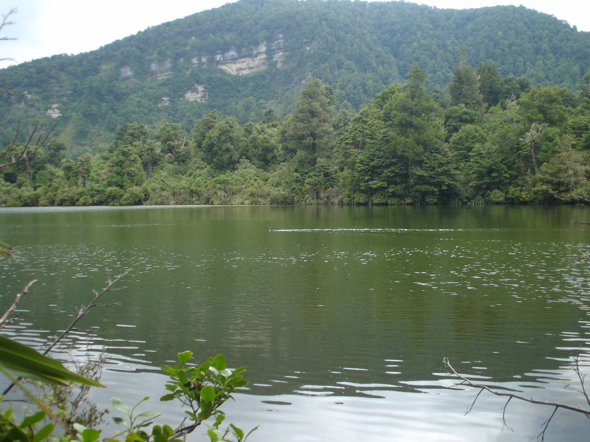
It was an easy to walk to the river; I stripped off and had a swim – great to feel clean and cool, after being very hot all day. We decided to walk the 10 minutes to the lake, and found it had a lot of bird life. The lake has a very muddy colour and we had no interest in a swim there.
We had covered 16 kilometres over about 7.5 hours.
Put plenty of insect repellent on that night and slept very well.
On Monday morning, it was cloudy on the tops, coming from the south-west, so we were confident there would no issues with wind as we got higher up.
After boiled eggs and a can of tuna for breakfast, we packed up and started the day with a walk down the river for 20 minutes. Then we turned up into a side creek as per the map and followed for around an hour to a sign (Ruahine Corner Hut 3hrs) pointing up another side creek. This was the Potae-Mangatere track. It had obviously been maintained fairly recently; all the fern was cut back, a lot of windfall tidied up and there were a number of extra orange track markers.
Finally we climbed up and out of the Mangatere River beside a waterfall. As we climbed towards Potae, we came to a turn-off to another track (Iron Bark Hut via ladder 6 hrs) and for us Ruahine corner Hut 1 hour – so we were not far from the turn-off that would take us to the tops of the main Ruahine Range.
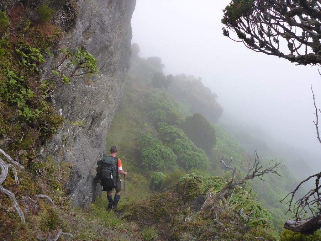
The track below the limestone bluff on the Potae track
Our next sign said Ruahine Range 2 hrs so we were heading east and still had some serious climbing. Around midday, we halted for lunch and a breather. A misty shower descended on us and it was a bit cooler. Only one thing for it: packs on and let’s get to the tops.
It was a long and steep haul, then we emerged from the bush to find signs in the tussock pointing to Totara Spur and Range Tops. So we had done all the climbing.
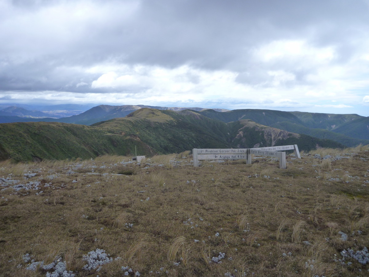
The Ruahine tops, at Totara Spur. The ridge track to Arranga in the background.

Kylie Biv, a wonderful spot.
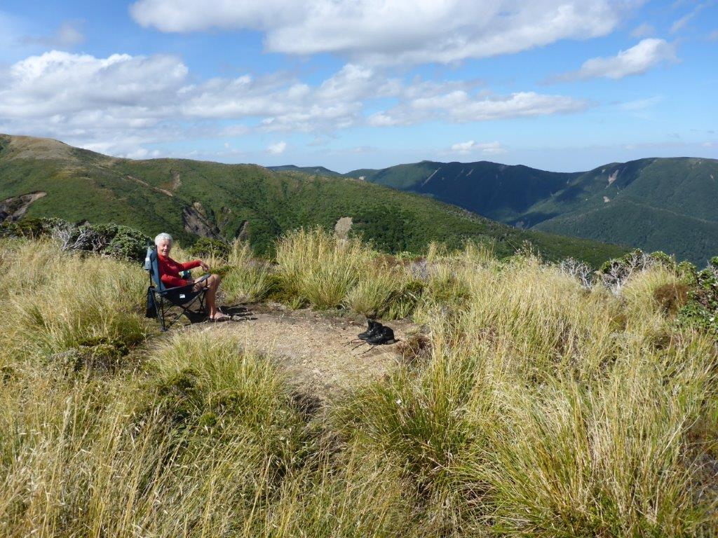
Ali in the armchair admiring the views.
The nor-wester blew gale-force during the night, buffeting the bivvy, but we knew it had withstood worse conditions than this. The decision for the morning was made for us: we had to get to Totara Spur and down to the Upper Mak. How would we cope in the wind?
Tuesday: We packed up early (no breakfast) and started the 15-minute climb back to the tops. We were in the lee of the hill; the wind was strong but not too bad… low clouds raced by at 100 mph … and when we hit the tops, we got a mighty buffeting.
Walking with a real stoop forward to counter the blast and trying to anticipate the next gust was very tiring; the walking sticks were a real asset in helping us keep our balance. After 40 minutes of battling towards Totara Spur, we were trying to spot some waratahs to indicate the start of the track down, but had seen nothing.
Alison decided to start up her i-phone and see where we were (and that was a battle in itself). The good news was we only had to walk east about 50 metres and we should see a waratah or two. Our navigation in the wind and cloud had been pretty good, and we spotted the waratahs heading down.
Now we were walking downhill with the wind, which was still very demanding, until after 20 minutes we were out of it and into the bush.
Down and down we went… a change from yesterday’s up and up! Finally, we could see the roof of the Upper Makarora Hut and five minutes later we arrived. It had taken 1.5 hrs from the signpost on the tops (just as stated). The hut is a comfortable four-bunker, very tidy, with a good fire, and water is from the river. Across the river is the track to Parks Peak Hut (2.5 hrs).
The sign on the Makarora River said Barlow Hut 4hrs down the river and only to be attempted by experienced trampers! The map shows the river twists and turns in many directions, so we knew it would take a while.
The trip down was just like any other to start with. The north-west wind was very strong, constantly blowing dust around us and whipping the water surface so you often couldn’t see what was underneath.
In several places, the river runs through narrow, deep gorges. Tramping down a river is very tedious and this was no different, same old, same old around every corner and a lot of patience required.
After five hours, we reached Barlow Hut, an eight-bunker in very good order, and well used. Two hunters were preparing to leave with their packs full of meat for the trip down-river. A snack bar and some chocolate and we were on our way again… it was heads down and go for it. We caught up with the hunters, who got a fright when they found us breathing down their necks. Seventy-five minutes later, we came round a corner to see Jack and Harry with a four-wheeler and trailer waiting for us by the Gold Creek, just as I had arranged.
Packs off and into the trailer, we headed for the Yeomans car park. Walking it takes a little over an hour; this took 15 minutes. As Jack said, a bit of an adventure for them as well. We got to his ute, boots off and into jandals; the feet were a bit white and puffy after walking down the river for seven hours. Jack and Harry loaded the four-wheeler and trailer onto the big tandem trailer, then up through three gates and past Stephen Wilson’s house (you have to ring him to get permission to get down to the river, never a hassle) and on to the Sunrise Hut car park to pick up Alison’s car.
It had been a really good trip and we had supported each another when things got tough. It took a couple of days to recover, but I would do it all again
Trampers: Alison Greer and Phil Enticott (reporter).

Sitting on a sunday evening, bored! I have been on f/book page about tramping and a name came up that I have read I suspect in Wilderness and a mention that he didn’t even know of the Ruahine Range as a comment that four youngsters had been airlifted out. Heavens, my tramping stomping ground with a well-respected and well-known (now late) leader in my younger days, all over a fair bit of this range. Four of us went to Lake Colenso, must be near 15 years ago. The husband of my friend said to his wife he wanted above all else if his tramping part of life came up to mention this particular tramp. The hardest he had ever achieved. Mine also, I am female. The bluff you mentioned as hard, Tony said if he had been able to put his hand between self and bluff he would have clicked his pack off; didn’t care if he never saw it again! It indeed was a hard walk and perhaps not as clear tracks as now. So well done, congratulations, no-one before us had walked to this lake in our club and none have since! Wanganui Tramping Club, Jennifer Scott