Roaring Stag Hut, Cattle Ridge Hut, Saturday/Sunday, February 25-26 – Map: BN34 Shannon

The new information board – top marks
Two old fellas and two girls (young at heart) set off from Putara road-end. The first thing we noticed was new signage for the tracks in the Tararua Range: ‘Welcome to the Mangatainoka Valley’. The bird’s eye map and layout is much better then the old.
We have all been to Roaring Stag Hut before, so we knew that we had a three-hour walk. The track sidles along the Mangatainoka River, crossing two swing bridges. From the second, the track commences the climb up to the junction for Roaring Stag (south) or Herepai (north) huts. We had left the car park at 9.30am and reached the junction at 11.00am.
The track to Roaring Stag is now a downhill, at first gradual, through some very muddy stretches, before dropping to the stream. It does not cross the stream at this point, but sidles alongside. When the time comes to cross, the best spot is just above a big log that straddles the stream. Soon there is another crossing, but much smaller, and you’re at Roaring Stag Hut. Alison and I arrived at 12.30 and had our lunch.
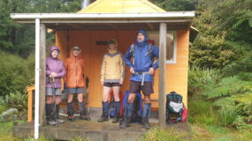
The two old fellas arrived and decided that this was to be their final destination for today. We posed for pictures, and then Alison and I set off. The ridge track to Cattle Ridge Hut is a 2km climb of 600m. The ridge is directly opposite the hut, after crossing the swing bridge, and both of us had wanted to get to the top of Cattle Ridge.
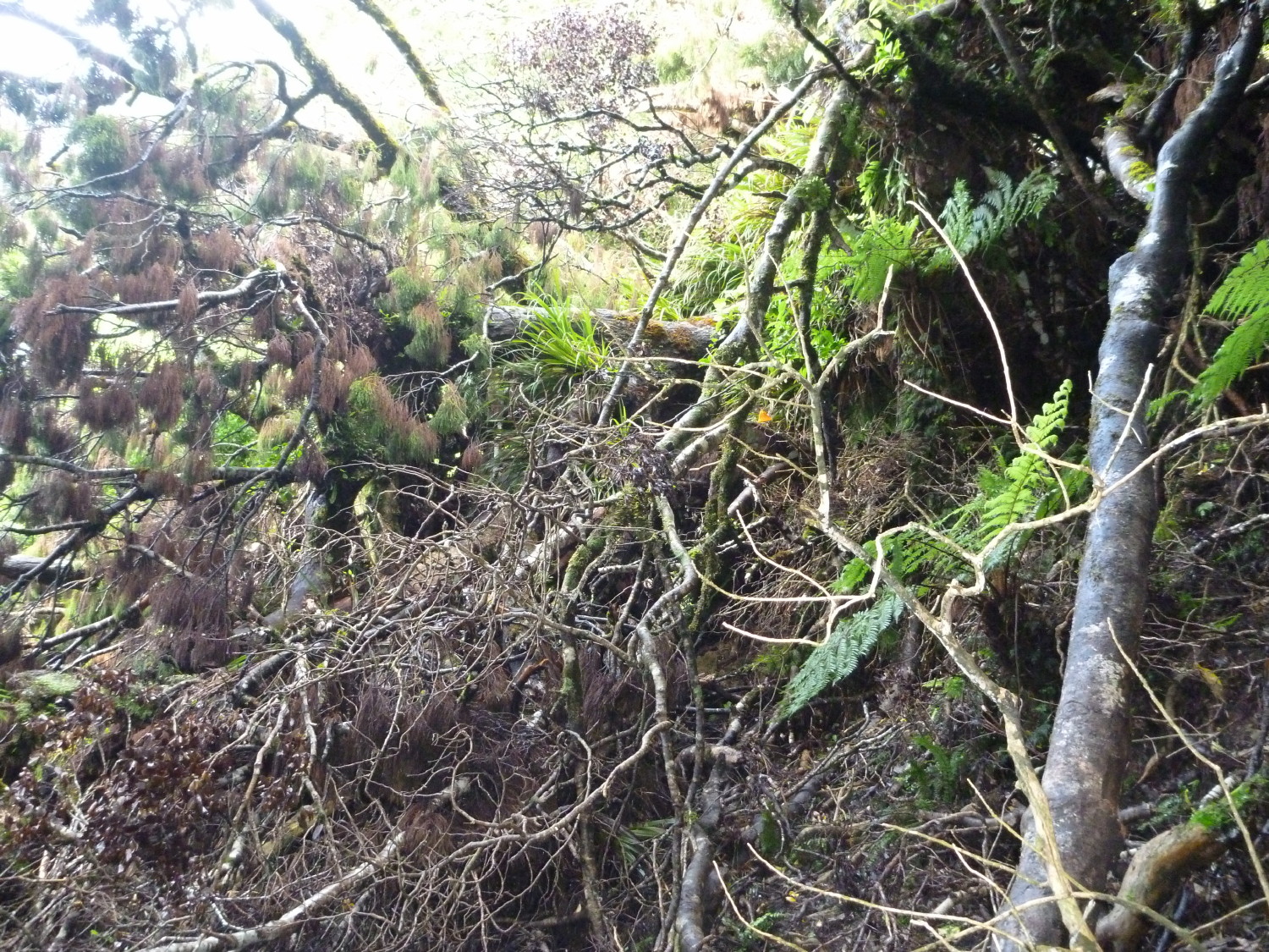
The debris through which we should have crawled
The track continues to climb through low scrub, and then eventually grass. Ted had advised us about some rocky sections which were near the approach to the hut. There are some stretching sections, which required leveraging up, which means that you can’t tank along. Alison was counting down the humps. Through the leatherwood and scrub, the track is easily discernable. We had a passing shower, and stopped to view the Roaring Stag Hut below..
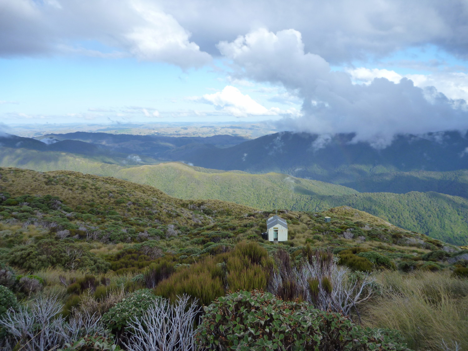
After climbing over another high point, the top of the range is visible, and another ‘lo and behold’: a tarn and the hut. It is not quite your orange hut as found in the Kaweka ranges, but still a welcome sight. A radio mast is attached at one end..
Mt Bannister with Arete behind it to the right, from Cattle Ridge
We decided to get further up the ridge and follow cairns up to a high point Pukeroa (1318). Cattle Ridge is broad, and we got glimpses of parts of the main range. We returned to our hut, cooked our dinners, and hopped into the sleeping bags to keep warm. A kind tramper had left a lot of women’s magazines, which helped pass the evening. They were the type you’d never buy yourself but are happy to read at times like this.
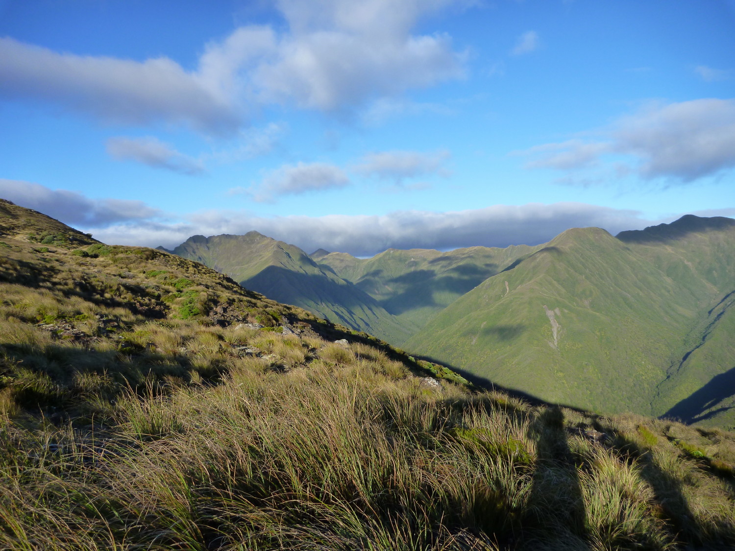
Mt Dundas (left) , with the track up to Dundas hut on the smaller middle ridge
The next morning, we woke to a cloudless sky, and made our way back up to Cattle Ridge. This time we got the full panoramic view. What a treat. We’d taken the map, and identified the peaks. Mt Dundas (1499) is directly opposite (yesterday we had noted the standards that mark the track down, and the smaller ridge up to Dundas Hut). To the north are East and West Peaks, to the south-west, Mt Bannister and in the distance, Arete (1505).
We made our way down, and retraced our steps to Roaring Stag. We were intrigued as to where we had missed the track, and discovered that the marker amongst the debris was where we should have crawled through, to pick up the track which traverses the ridge, heading south, before heading steeply uphill..

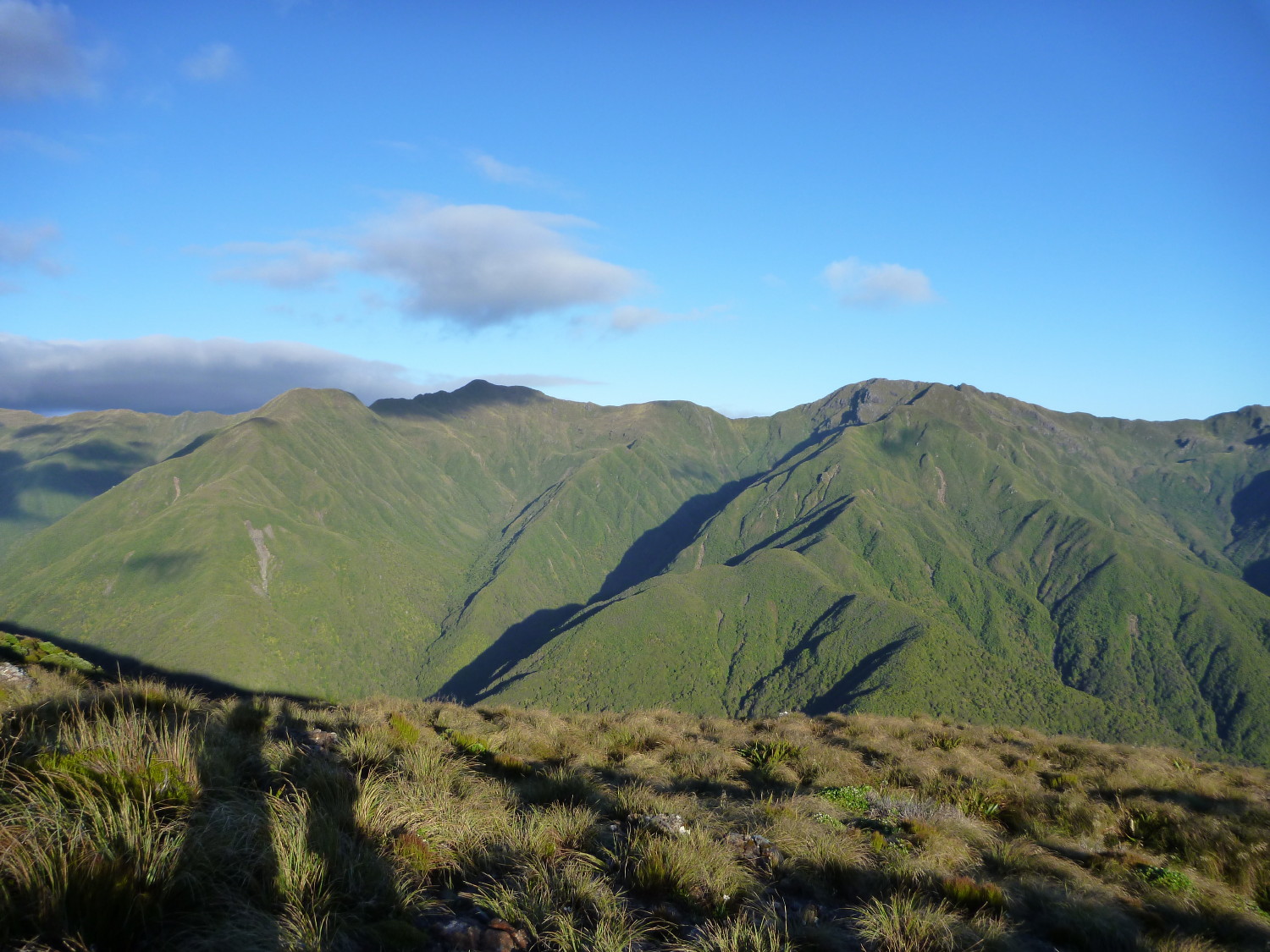
East and West Peaks
We made our way steadily back up to the ridge junction, and then commenced the downhill over the mud and tree roots that are part of the tramping experience in the Tararuas. On the way, we met another tramping party with a dog who did not like me. Tough. We passed them, and picked up the pace to get back to the old fellas, who had made their way out 45 minutes earlier.
Alison and I loved the challenge and were rewarded with wonderful views from Cattle Ridge. My muscles took a few days to come right, but I’d love to do more tramping in the Tararuas.
Trampers: Ted Angove, Paul Exeter, (the old fellas), Alison Greer and Julia Mackie (the girls)

Leave a Reply