Mt Hikurangi, East Cape, 24-26 April 2021
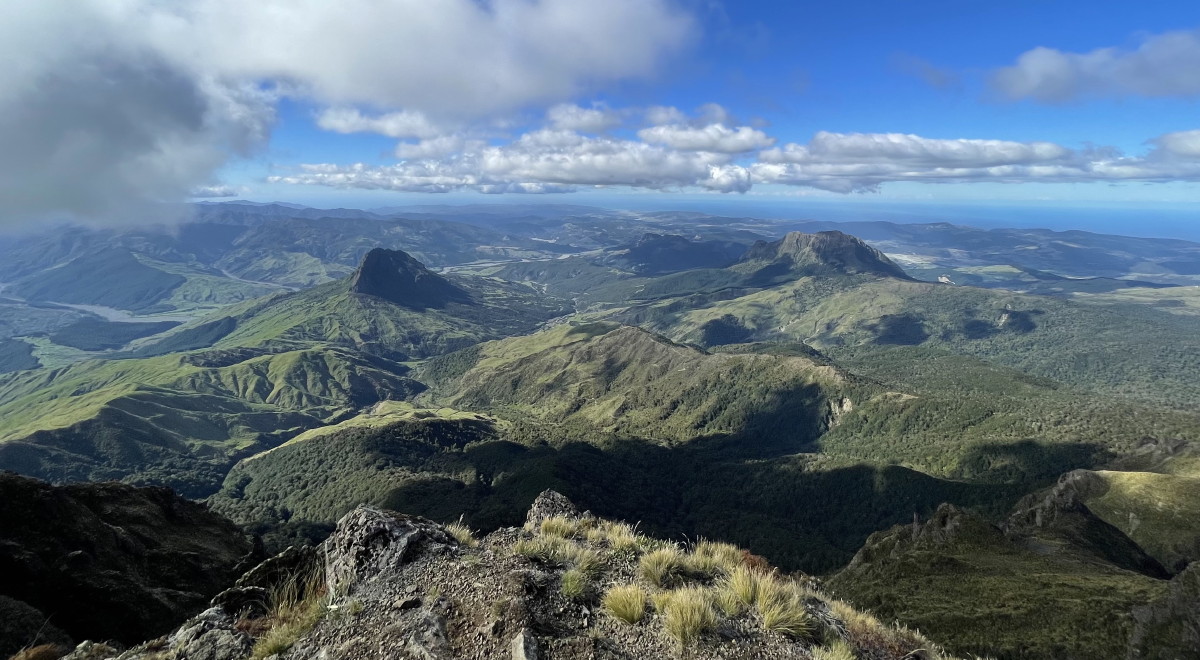
Banner Photo: The view from the summit ridge
At last we had the weather and permission to climb Mt Hikurangi. Three previous attempts had been thwarted. This time, 12 club members were raring to climb the sacred Te Ara ki Hikurangi, the highest non-volcanic mountain in New Zealand (1752m).
The drive up to the East Cape started on Saturday, with a break in Wairoa, lunch in Gisborne and on to Tolaga Bay.
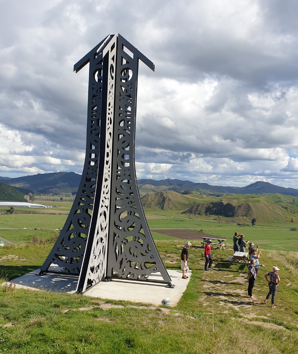
The Beacon of Light
Background: Big, bold and brilliant to see lit up at night, the 12-metre high sculpture on Hoturangi Maunga in Uawa/Tolaga Bay was resurrected in October 2019 to commemorate Tahitian ancestor, navigator and priest Tupaia and his arrival at Opoutama [Cook’s Cove] on the Endeavour in 1769. This is a stunning traditional Māori art form that’s also an important conversation piece on the dual heritage and shared future of Aotearoa New Zealand.
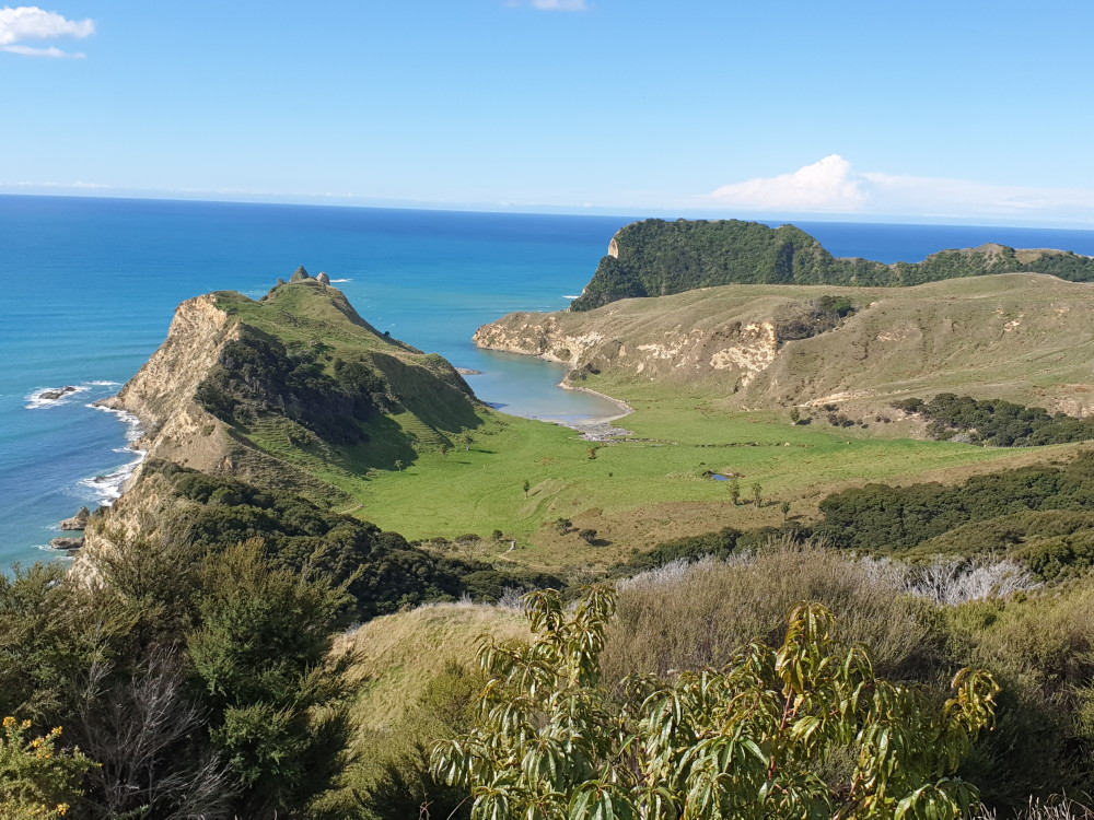
Cook’s Cove from the lookout
When we got back to the car park, we continued walking around to the 600-metre-long wharf; there were some people fishing off it. Locals love the wharf because it’s part of Tairawhiti history.
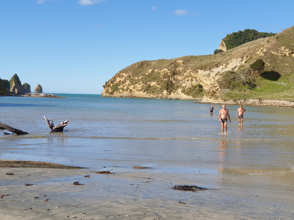
Water babes
The next day was Anzac Day, so some got up early and went to the local service which they described as very moving, with people of all ages attending.
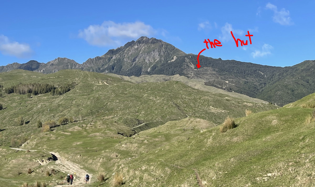
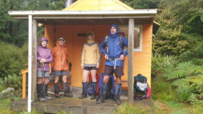
Looking up at the hut and Mt Hikurangi
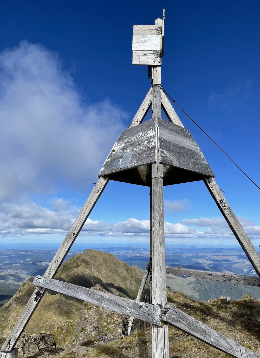
The trig
It was a long but satisfying day and a fun evening. The hut had had an annex, so there was space and a mattress for everyone.
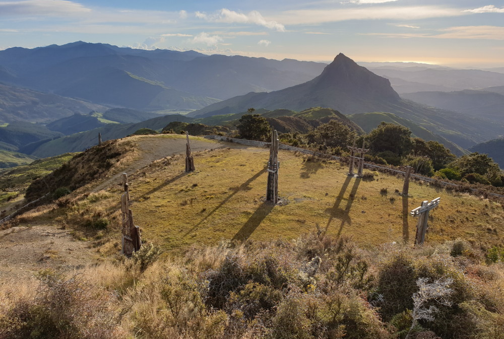
The nine sculptures and the knife-edge Wharekia seen from the Hikurangi Track
On the way down, we went to view the nine Maori whakairo (sculptures). They sit on a plateau and were carved for the Year 2000 Millenium celebrations.
Background: These whakairo represent the demigod Māui-tikitiki-a-Taranga and his family. Māui is regarded as an ancestor by Ngāti Porou and tradition holds that his waka, Nukutaimemeha, rests petrified on the mountain. The carvings tell the story of Maui fishing up the North Island, which has particular significance to Ngati Porou.
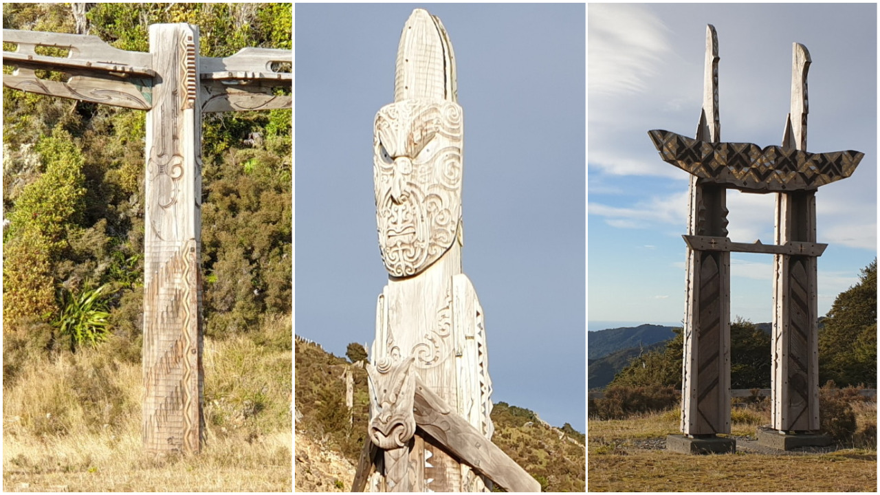
Three of the nine whakairo
They are truly spectacular.
Heading home, we had lunch at Gisborne and a quick stop at Wairoa, and arrived back around 5pm. Thank you very much, Alison, for a great tramp and weekend.
Trampers: Alison Greer, Julia Mackie, Fiona Bryant, John Dobbs, Jenny Burns, Robyn Smith, Marie de Roles, Bruce Hodgson, Lynette Morgan, Simon Hill, Doug Matheson and reporter Dorothy Sole
Note: Hikurangi Hut must be booked prior to departure through Te Runanganui o Ngati Porou:
Address: 1 Barrys Avenue, Ruatoria 4032
Phone: +64 6 864 9004
Email: info@maungahikurangi.com
$15 per person per night.

Leave a Reply