Arthur’s Pass: March 2016. Part 1.
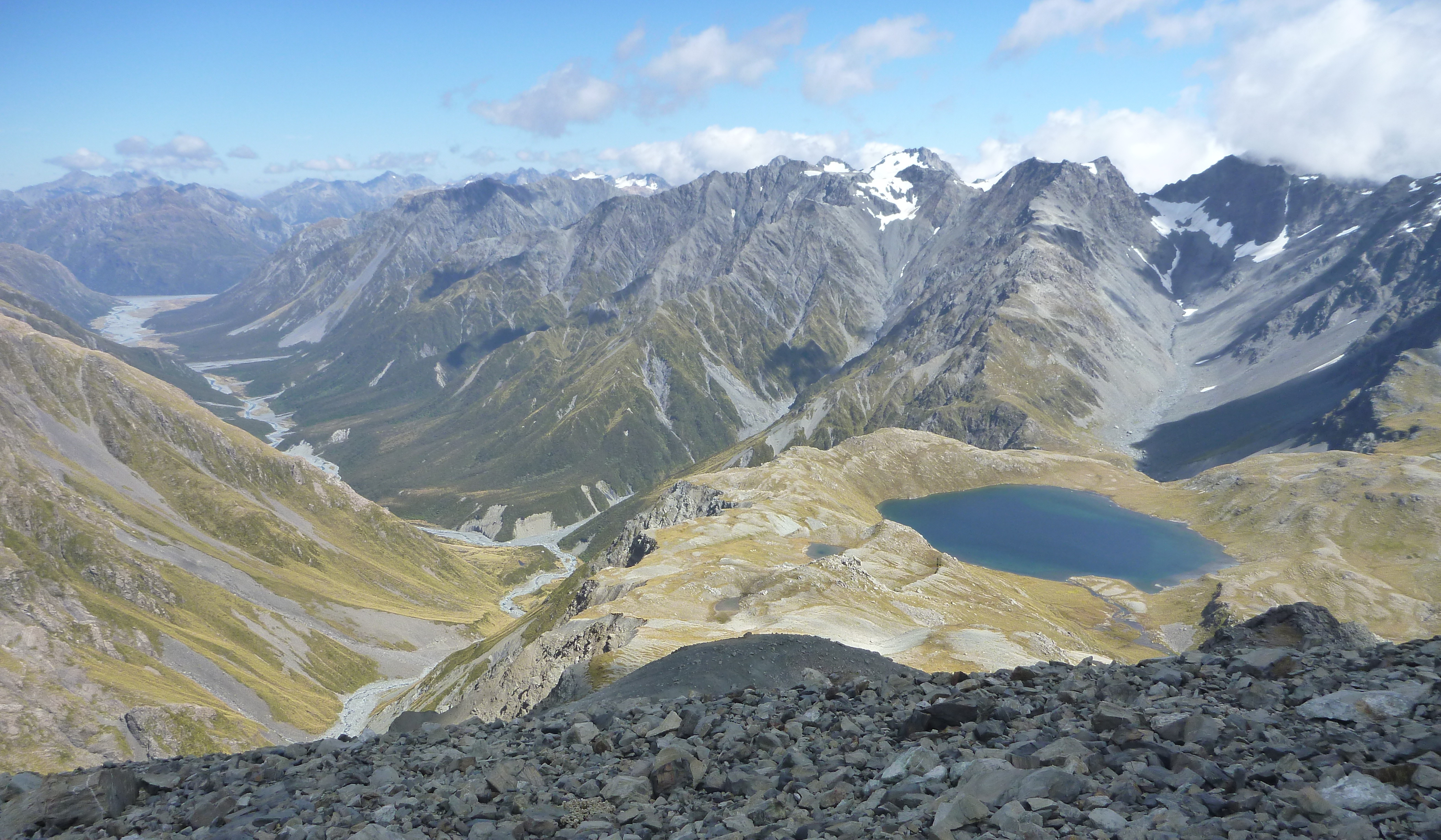
The banner picture is of Lake Browning and the Wilberforce River, taken during the climb up Mt Harman.
Three plus two were: Harman Pass, Whitehorn Pass, Browning Pass, Pope Pass and Kelly Saddle Pass.
Day 1: We caught the bus eastwards to the far side of the Waimakariri River to begin on the longer but drier route, with the aim of keeping our boots dry for a while stopping at Anti Crow Hut for lunch. (Further on, we had to climb and sidle, as the river was hard up against the side of the valley.)
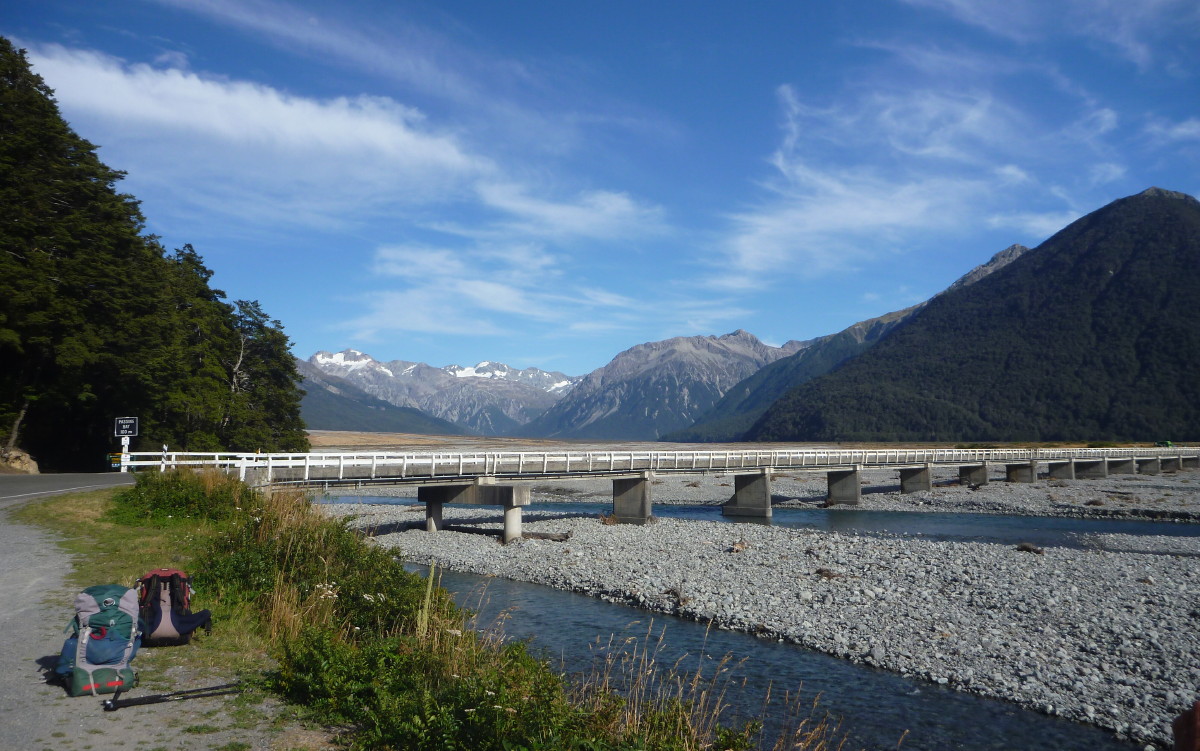
The Waimakariri River Bealey Bridge, our starting point
Our destination, Carrington Hut, is unusual: it is like two huts stuck together, with an entrance area in the middle and separate bunkrooms and cooking areas at each end. We were also able to call up DoC during office hours on the hut radio to get the latest weather forecast.
Day 2: We set off up the White River to the cableway where we crossed and started climbing up the Taipoiti River. The weather was not that good: misty rain and poor visibility on the tops. Julia suggested: Why not turn back now and try again tomorrow when the weather is forecast to be better? We would have views and better visibility to cross the passes. We soon agreed.

Heading up to Harman Pass
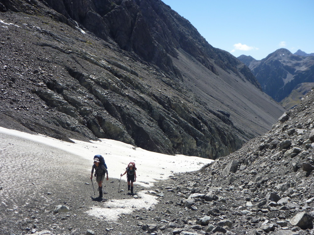
Heading up the Whitehorn Clacier
Day 4: We waited for the early morning cloud to lift as we needed good visibility to go over the tops. We departed at about 9.40, going up the Wilberforce River, past a monument and onto a zig-zag track at the bottom of the climb. Further on, the last steep section goes up the side of a shingle gut to reach the top, where we sighted Lake Browning. This turned out to be a good lunch spot.
After lunch, we climbed a spur which led towards Mt Harman. We had great views down on Lake Browning and Mts Learmont and Walter opposite. We saw chamois below Mt Harman as we climbed to its shoulder (1900m) and sidled round on a wide shingle bench. From here, we headed down a shingle slope, past a rocky outcrop and onto another shingle slide to arrive at Pope Pass. Another good place for a break. Then we headed off down a dry stream bed at the start of Julia Creek. Further down, we found bluffs on the right side blocked our progress so dropped down and crossed a glacial snowfield to continue the descent. After going down the stream for a while, it started to close in, so we climbed onto a shingle bank on the true left and followed this down to the valley floor. It turned out that the stream exited the bluffs via a good-sized waterfall.
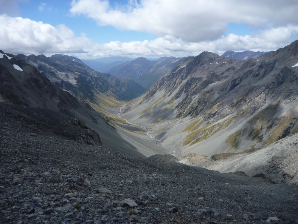
Julia Creek valley from above Pope Pass
Day 5: We went looking for the track. The cairn down by the river suggested a track, but it could have been for people coming up the river. However, once we headed back to the last track marker, we soon found the route.
Thirty minutes later, we reached the three-wire bridge over Mary Creek (which flows from Harman Pass) and arrived at Julia Hut. At first, we could not find the old but restored hut. We discovered that the track leading to it was 100m back up the path we had come along. On the West Coast, there are few DoC direction signs… The restored hut is a gem. Thanks to all those involved in ensuring it is part of the heritage of this area.
After breakfast at Julia Hut, we headed off down the track by the Taipo River. We were all tired from the previous day but this section was well defined, which made for easy going, and we reached Mid Taipo Hut after about three hours. After lunch at Mid Taipo, the track covered large sections of river flats and we made good progress. We had to climb up a fresh wet slip and sidle around to cross the river on a cableway. Heading on down the flats by the river, we picked blackberries before finally arriving at the relatively new Dillon Hut, a 10-bunk standard DoC hut. We arrived early enough to have a wash, cook a dehy dinner and relax. There were wekas around the hut and we could hear kiwis screeching during the night.

The Caroll Hut, with views to the valley floor
We climbed on past a group of tarns, then sidled around a high point and dropped down to Kelly Saddle. Going across it, we came to Carroll Hut which is located on a bench with great view of the valley floor and the main road, the Otira River and across to the actual Arthur’s Pass. Carroll Hut is a new standard 6-8 bunk DoC hut. From Carroll Hut, there was a steep descent down to a DoC campsite and the main road.
At the main road, we tried hitching. After a few minutes, a guy in a twin-cab ute went by. He turned around, came back over the one-way bridge and offered us a lift. That was very kind of him. We were soon back at Arthur’s Pass village, getting cleaned up before savouring the delights of the Wobbly Kea cafe that evening.
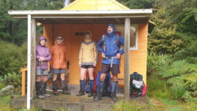
Party: Alison Greer, Julia Mackie and reporter Geoff Donkin.

Good to see the Napier Tramping Club venturing into the Southern Alps! I did my tramping apprenticeship with the club as a teenager, which served me well when I headed south for university and real mountains. Great to see some of my mentors still chugging away in the hills, I must try and make it along to a meeting next time I am back in the Bay.