Coppermine Creek – Wharite Peak, Wednesday November 11 2009. Map: BM35
Trampers: Murray White, John Marshall, Keith Moretta, Ron Morison, Ken Ross, Peter Slagter, Vic Bullock, Penny and Arthur Mead, Robin Smith, Kelvin Shaw, Thelma Tasman Smith, Manfred Hausler, Jeanne Van Den Hout and Alison Greer
A full van headed south: Destination, Wharite Peak – the last high point of the Southern Ruahines, the one with the tall transmitting tower atop. The forecast was once again for rain and wind – and sure enough, just south of Dannevirke, spots appeared on the windshield.
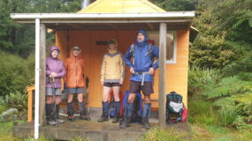
Maps came out as we discussed the best road to turn off the main highway and head west towards Maharahara. Ken said with confidence: “I’ve got an old map that shows a road right to where we want to go”. Yeah right, Ken. It took us up a farm track with hardly any room to turn around! So it was back the way we had come and taking Heretaunga Rd, arriving at the car park around 9am. Raincoats where dragged out of packs once again, then it was a pleasant walk along the side of Coppermine Creek, reaching the junction after about 40 minutes. From here, it was a steady climb through bush and leatherwood to a small saddle. The view from here was of wind-blown rain and thick cloud, although the cloud did seem to be lifting.
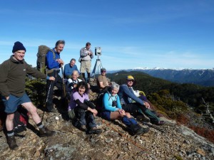
We decided to continue on but after doing what appeared to be the majority of the climbing, the conditions did not improve so we turned around and scampered down to the relative calm of the main track. We thought we would wander further up the track and check out the copper mine itself, but a big slip blocked our way. We settled down for an early lunch to discuss options. Funnily enough, at this point, the sun came out, but Wharite Peak was still covered.
After a leisurely lunch, we returned to the same track junction – this time taking the loop track signposted back to the car park.
But wait! Where was Keith? No one noticed he was not with us for lunch, so where could he have gone? Who saw him last? After much debate, we decided to go on and that he would turn up at the car park. Some thought this loop track would be a doddle along the stream, but oh no: it was straight up a ridge, probably gaining just as much height as we had in the morning.
Lots of moans and groans, but after 45mins or so, we reached the top and another track going down to Billy Goat Creek. We turned right, coming out of the bush and following the fence line down, finally crossing farmland to reach the car park and find Keith waiting and wondering what had happened!
The rain was setting in again, so we high-tailed it out of there – but all agreed it had been a good, if confusing, sort of day.


Leave a Reply