Round Mt Ruapehu Track, Mon 2 – Fri 6 November, 2020.
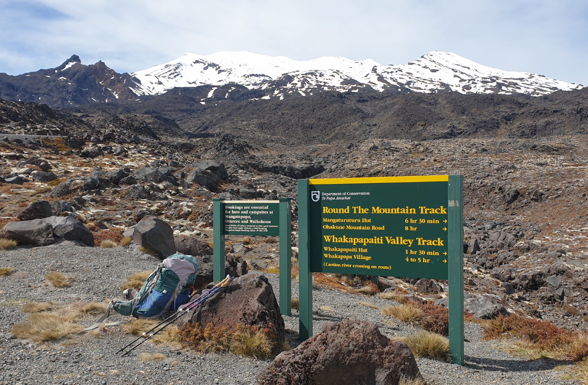
Banner Photo: The start at Scoria Flat, and the mountain view
Day 1 – Scoria Flat to Mangaturuturu Hut (reporter Bruce Hodgson)
As always with Alison’s organising, the logistical detail for this trip was finely tuned.
Eight of us were dropped at the start point near the top of the Bruce Road to get a head start while three drivers shuttled cars to the track end at Whakapapa Village and then headed back to the start point; being faster walkers, they would catch us up.

Mt Ngauruhoe also in view on Day 1
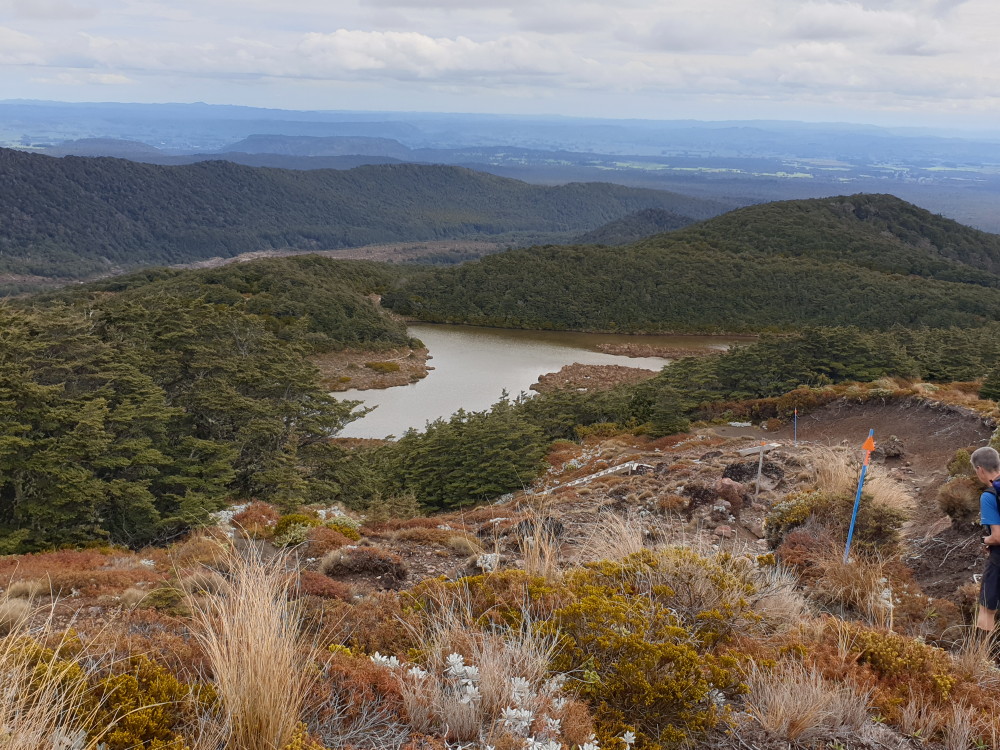
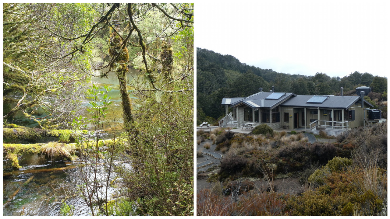
Lake Surprise
Our first day’s destination was Mangaturuturu Hut on the western side of Mt Ruapehu. This was the hardest of the five days. The track was particularly difficult underfoot. The steep track formation has been a runoff conduit for the soft volcanic ash soil to be eroded, leaving metre-deep mini-canyons. Too deep and narrow to walk in and the sides too steep and slippery to make fast progress. The terrain was constantly up and down and much of it booby trapped with loose rocks and boulders.
As we stumbled on, slipping and sliding, my imagination ran away with me. Alison may have set us up for some sort of practical joke. We couldn’t see her and the other two drivers following and I wondered if they hadn’t driven to a secret road taking them directly to the hut ahead of us. The Central Plateau is a magnificent, wide open and mountainous barren landscape with unlimited visibility. After three hours of slog, we searched the landscape behind and at last, with keen eyes, spotted three tiny specks in the far distance. It reminded me of the movie Butch Cassidy and the Sundance Kid. The Marshal had gathered a posse and set off in hot pursuit across the prairie. Each time we looked back, they were just a wee bit closer and our horses were tiring.
We completed our six-hour tramp, skipping down 331 wooden steps and a steep, boulder-ridden creek bed on the last desperate leg to Lake Surprise and on to the hut – just in the nick of time before we were run down. A little bit of silly competitiveness had afflicted me.
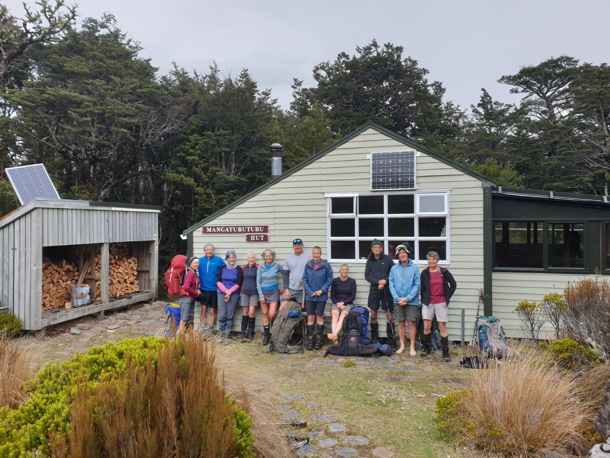
Mangaturuturu Hut and all 11 of us
Mangaturuturu Hut has ten bunks. We numbered 11, plus six others sharing the hut. This gave us an excuse for some close social bonding on the floor of the hut conservatory. Anticipating this, most of us had brought our blow-up mattresses.
A five-day tramp takes some personal organising and responsibility for things like warm clothes, food and so on. But sometimes there is a lapse. This time it was John Dobbs’s turn; he discovered that he had forgotten to bring his food.
Day 1 had been enjoyable, dry, with a pleasant, even temperature.
Day 2 – Mangaturuturu Hut to Mangaehuehu Hut (reporter Alison Greer)
Day two dawned overcast and calm; Ruapehu was not showing her full self.
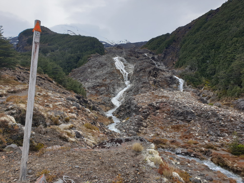
The Cascades
As the majority of the group had slept on the floor and with the prospect of rain later, we were up and ready to leave by 7.30am. A group photo taken, it was off to tackle today’s obstacle, ‘The Cascades’, which reared up ahead from the valley floor.
The Mangaturuturu River rushes 200m down an old lava flow forming a series of cascades, the silica cream-coloured bed contrasting with the shiny black of the lava. The track ascends steeply over rocks and crosses the stream before climbing again through an area of boulders, finally reaching the ridge line.
Fabulous views across to Lake Surprise and down into the Mangaturuturu valley are the reward. Ahead, the Ohakune mountain road and the 3km downhill to the Mangaehuehu Hut car park.
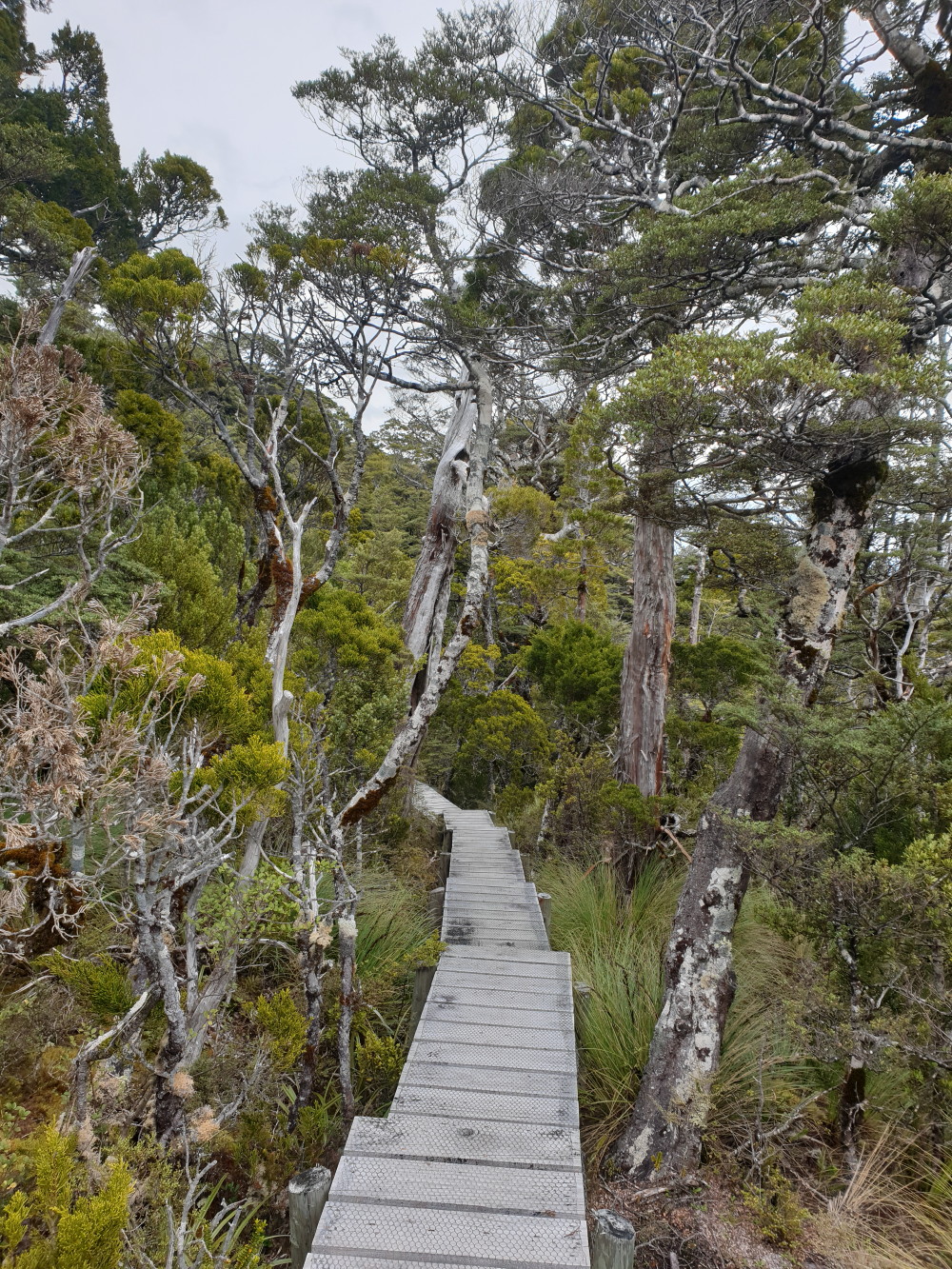
Boardwalk makes it easier across swampy terrain

Mangahuehu Hut
On this section of the RMT, we would be in beech forest, so different from the exposed ridges of yesterday. Mountain cedar, with its distinctive striped bark and moptop-like head, mixed with mountain beech making up the bulk of the forest stands. The track runs transverse across the flanks of the mountain, in and out of gullies, over small streams and sometimes breaking out into the open. Boardwalks weave their way across boggy terrain, only to plunge back into the bush again.
Waitonga Falls was admired and photographed, swingbridges over rocky rivers and canyons crossed. Then more boardwalks, some of which need a bit of repair, then finally the open tussock leading to the hut.
The forecast rain had not arrived, so there were great views to the south and west and Ruapehu started to show herself, eventually revealing Girdlestone Peak and Tahurangi Peak. As it was early afternoon when we arrived, we spent the rest of the day relaxing. Matt pitched his tent (on the windiest spot he could find) and John D brought out a game (Table Talk I think it was called). Perhaps not the best ever played, but it filled in time until dinner. About 7pm, two Filipino blokes arrived; they had come from Waihohonu Hut, taking 11 hours!

Mangaeheuhu Hut (bottom level)
We made room for them and settled down for the night, Bruce deciding to sleep outside on the verandah, and Julia decamping there sometime in the night, as there was lots of snoring going on inside! The Filipino blokes told us they were rising early as they had another long day ahead, but whoa – how early is early? That’s another story.
Day 3 – Mangaehuehu Hut to Rangipo Hut (reporter Julia Mackie)
The day started at 4am! That’s when the two Filipino trampers got up and cooked their breakfast (outside on the verandah table, where Lynette joined them and got their life stories). They disturbed us all. So everyone was awake and up at 6am, and more than ready to hit the trail again at 7.30. Still no rain, and views of Mt Ruapehu only now and again as the cloud hung about the mountain above us and then would clear again.
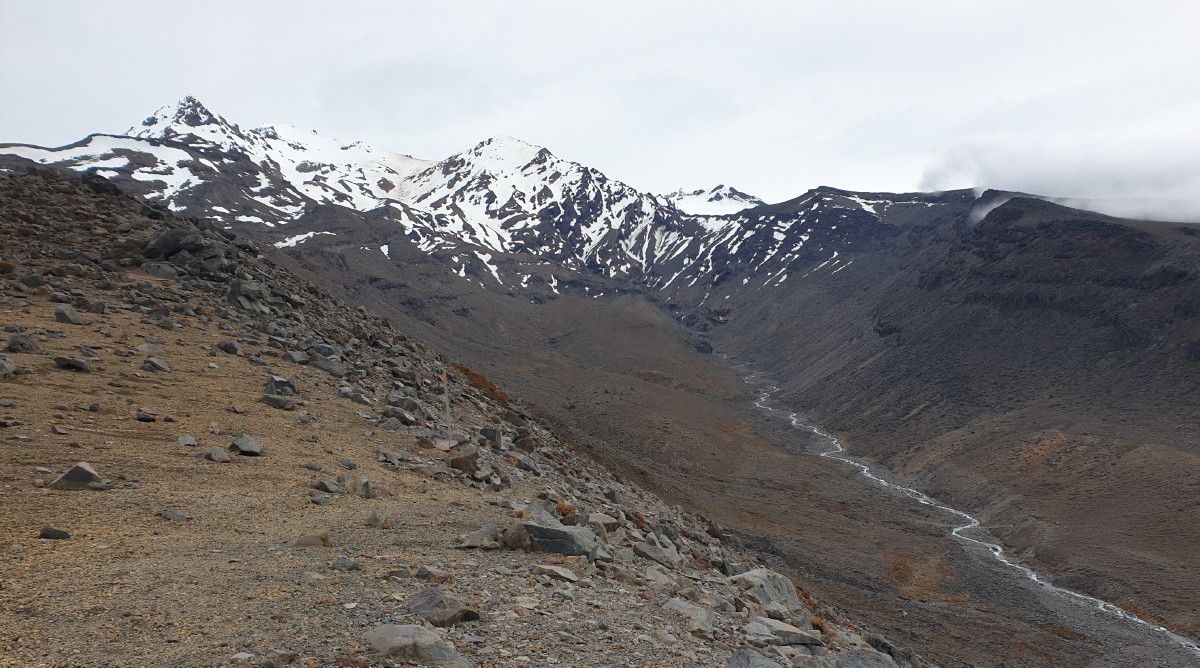
The glacial Wahianoa River valley and swingbridge
This section of the track is in and out of sections of beech forest, before walking on volcanic rock and silt in and out of river valleys. One of the highlights is reaching the rim of the Wahianoa Gorge. The opposite side of the gorge is reached by a 100m descent down to a new bridge, and up the other side again. It looks daunting from the rim, but is in fact a piece of cake.
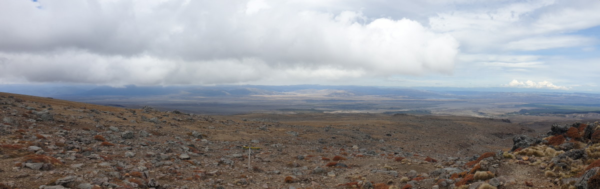
The Rangipo Desert from the hut
Then on towards the hut with views of the Rangipo Desert. Signs indicating the edge of the Army Training Area could be seen in the distance below.
Rangipo Hut has great views across the Rangipo Desert to the Kaimanawa Ranges, where the triangular shape of Makorako stood out. We could even see the northern Ruahine Ranges in the south-east, along with Lake Moawhango, SH1 (Desert Road) and power pylons. We gazed at trucks and cars heading towards each other on the road, waiting for the crash. None came, but the illusion was fascinating.
The day was colder and so was the hut. Plenty of firewood is stored off the verandah, and John D set to work to make some kindling so we could light it at around 4pm. It soon had us stripping off our puffer jackets. They needed to go on again when ‘tramping’ to the toilet, however, which is uphill behind the hut.
Early to rest to catch up on lost sleep, warm and toasty; a great night in the hut.
Day 4 – Rangipo Hut to Waihohonu Hut (reporter Lynette Morgan)
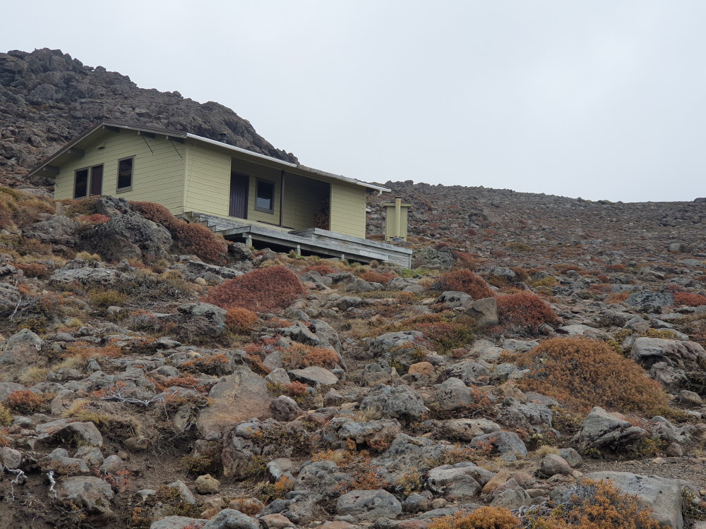
Rangipo Hut and the loo further up behind the hut
Just as well the weather was good when we’d arrived at Rangipo Hut the previous afternoon to enjoy the incredible views out as far as the Kaweka Range, and appreciate just how expansive the Rangipo Desert area is (although the Kaimanawa Range was shrouded in cloud).
We awoke on Thursday morning to low, thick cloud, with heavy rain forecast for later that morning. We were all packed and ready to leave by 7.30 as we wanted to get to our last hut – Waihohonu – before the rain set in. Our route was poled, all the way.

The swingbridge crossing the Whangaehu River
The Rangipo Desert is an amazing mystical terrain when shrouded in low cloud. It is the only true desert landscape in New Zealand.
To start with, we could only see four poles in front of us as the cloud was so thick, so we had to stick together in groups. Walking across the desert, we encountered gale-force winds and horizontal rain whipping our faces so, all in all, unpleasant but incredibly exciting at the same time. You could almost imagine yourself being an ‘explorer’.
The first major descent was down into the Whangaehu River which originates at the Crater Lake near the top of Mt Ruapehu, carving a deep gorge through the rocks as it flows downstream. A swingbridge crosses high above it, and the sheer rock face on the northern side is spectacular.
The signs advising trampers to keep walking due to the ‘Extreme Lahar Risk Next 400m’ are a wake-up call that Mt Ruapehu is an active volcano.
After crossing the Tukino Road, the landscape changes to seemingly endless massive volcanic dunes, divided by huge valleys. Up one side, down the other; this continued for some time.
Ohinepango Springs and Waihohonu Hut
As we descended, getting closer to Waihohonu Hut, the weather had improved slightly. Four of us decided to detour to have a look at the crystal-clear Ohinepango Springs before carrying on to the hut, finally arriving at 12.30, just as the drizzle started to settle in. The expected rainfall for the area was 70mm from 3pm-3am and it didn’t disappoint. It bucketed down in sheets all night, but by morning (our last day) it had become a light drizzle.
Time to head out and home.
Day 5 – Waihohonu Hut to Whakapapa Village (reporter Marie Deroles)

Simon (l), and Elly (r) in Waihohonu Hut
Heavy rain warnings for overnight early morning had us worried, as did a howling gale that came up in the night. But the day dawned with little wind and showers. So at 7.30, we headed off, clad in raincoats which stayed on for the duration of the tramp.
The terrain is covered mainly in tussock with no cover to stop for snacks or an early lunch, so they stayed stowed in the raincoat pockets. Brief sunny patches appeared, to give us some views and a lovely rainbow stretching between mountains, but these quickly disappeared, obscured by rain.
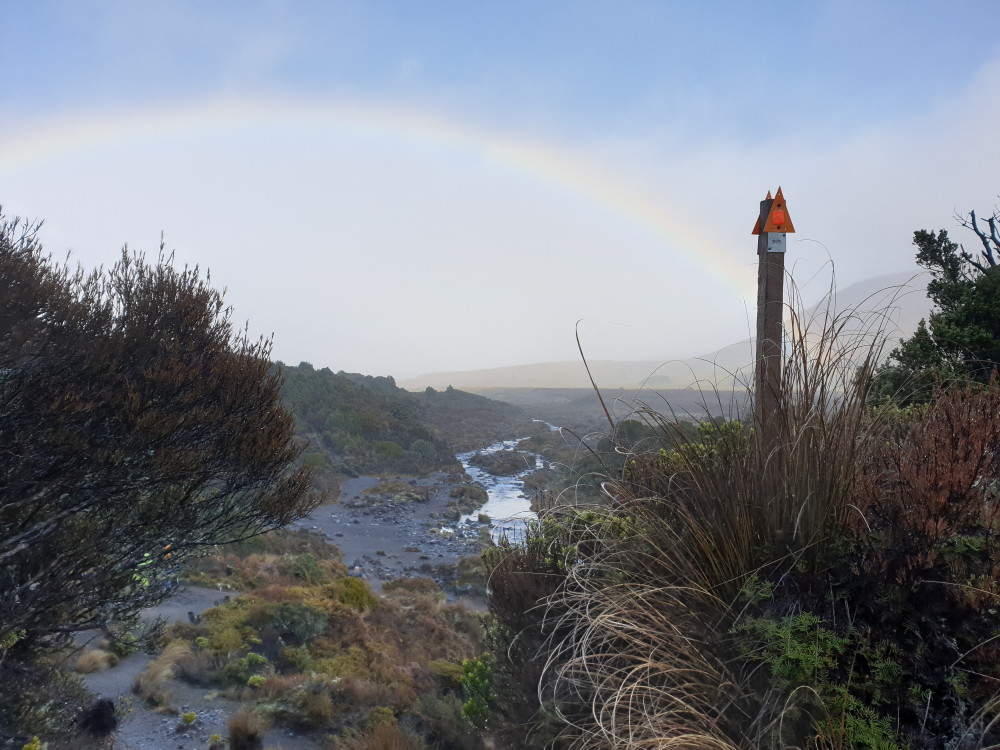
The rainbow in fine drizzle
Lower Tama Lake could be seen in the distance on our right before the turn-off for the Tama lakes track. From this point, the track takes on a more pedestrian feel with lots of boardwalk stairs and a well-formed track. At the turn-off to Taranaki Falls, the group was spilt between those heading straight to Whakapapa Village and those wanting to take in the falls on the loop track.
Last time the boots go on, yay!!
Most of us were back at the cars round 11.30, so had managed to shave off a good hour on signed times. Coffee and nice food was called for, so we found a cafe in Turangi that fitted the bill. Then it was back in the car and home in Napier by 4pm.
What a brilliant tramp. Amazing terrain and great views, with good company. Many thanks go to our esteemed leader Alison and the drivers who took us to this wonderful place.
Trampers: Bruce Hodgson, Lynette Morgan, Marie Deroles, Sue Martin, Elly Govers, John Dobbs, Juliet Gillick, Matthew Nisbett, Alison Greer, Julia Mackie and Simon Hill

What a great trip! Very jealous.