Smith Stream, Ruahine Tops, Waikamaka Hut, Waipawa River, Sat-Mon 6-8 February 2021. Maps: BL36 and BK36 Photos by Phil Enticott and Julia Mackie The planned tramp was changed to make it easier for bodies that aren’t getting any younger. But it was still no walk in the park. It started at the Waipawa River car… [Read More]
Young guns did it again
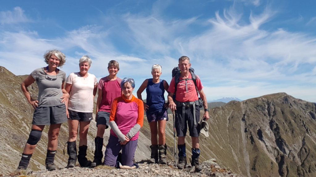
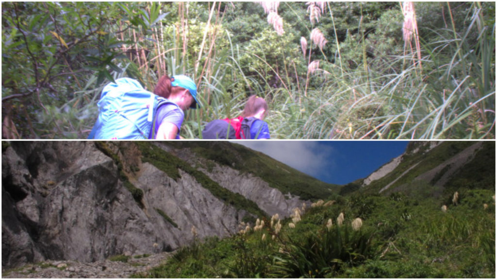
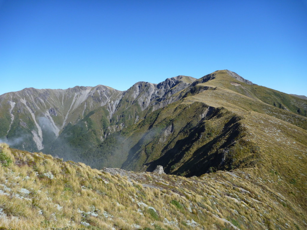
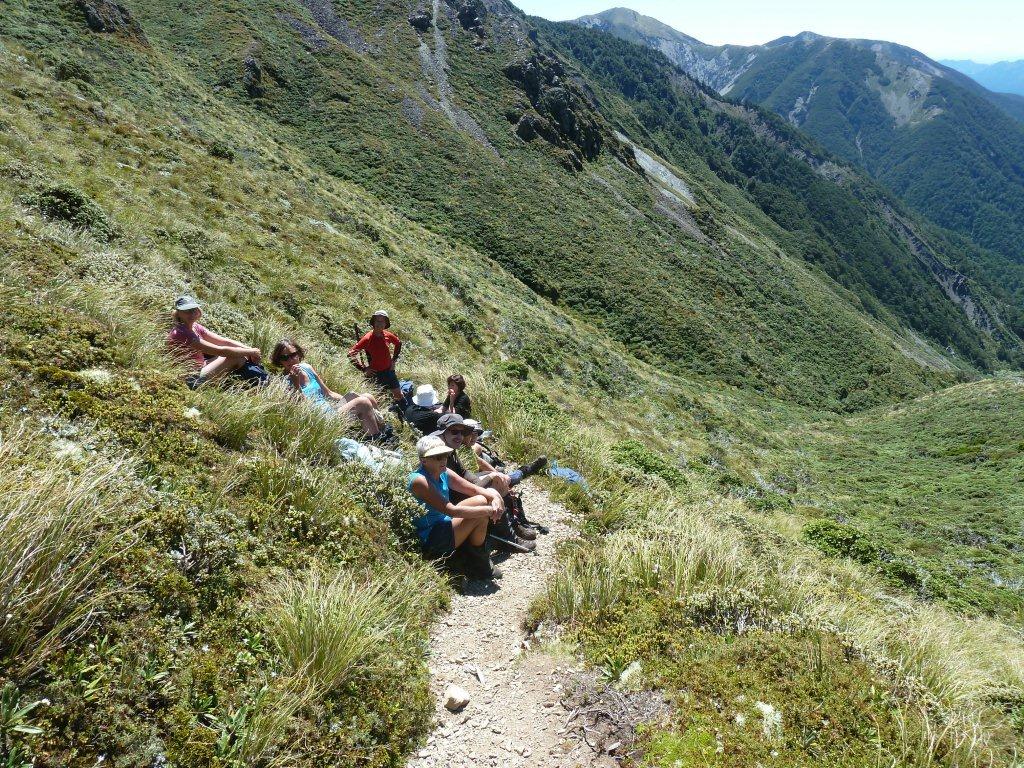
Te Atuaoparapara, Ruahine FP, Saturday 28 November 2020. Map BK36 Banner Photo: Te Atuaoparapara with Waipawa Saddle on the left There were just eight on this tramp, and seven of us doing the loop. Why so few? Perhaps it was the ‘eight hours’ in the tramp description, perhaps it was nerves about the scree slope;… [Read More]
A challenging day tramp in the Ruahine Ranges
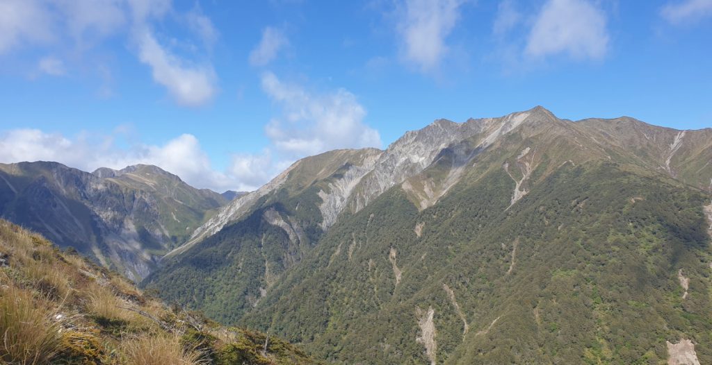
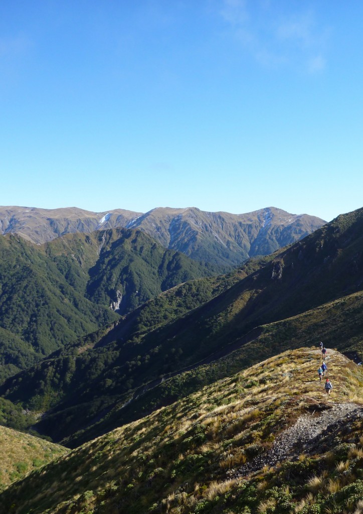
Sunrise to Te Atuaoparapara (aka 66), Waipawa Saddle, Saturday, 2 December 2017 Map: BK36 Banner: The view across to Te Atuaoparapara and Waipawa Saddle It was a still day and hot work on the climb up to Sunrise Hut. We could see thunder clouds gathering to the east. As often happens, we met some people… [Read More]
Waipawa Saddle and return via the Sunrise Track
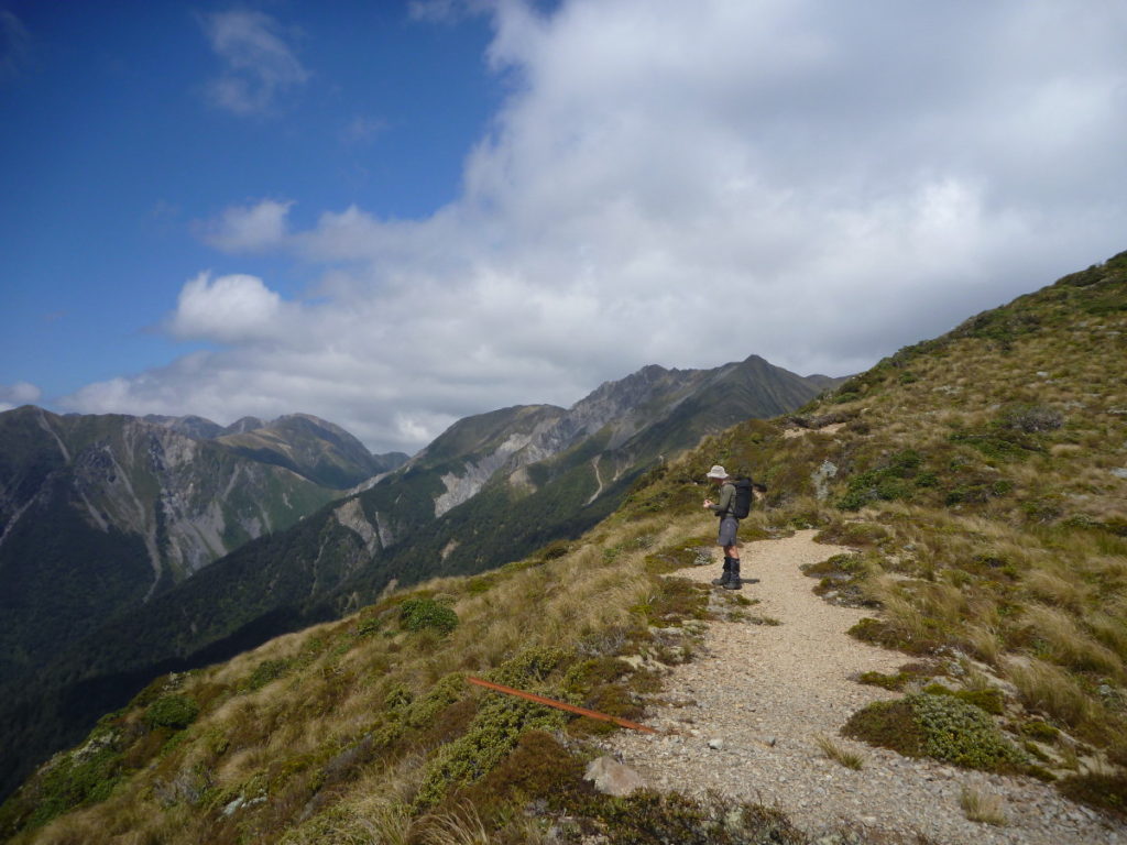
Waipawa Saddle, Saturday 28 January 2017 Ruahine FP, Map: BK36 Photos: Sue Martin. Banner: Making our way up the river bank, and the view of Waipawa Saddle from below. We headed off up the Sunrise track. The group decided that they wanted to go to Waipawa Saddle so at the saddle track junction, we headed… [Read More]
Red lining a few more Ruahine Forest Park tops
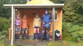
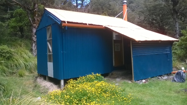
Smith Stream Hut, Ruahine Forest Park, ANZAC weekend, April 25/26 2015. Maps: BK36 and BL36 Les and I are gradually crossing off parts of the Ruahine Forest Park that we have not tramped (it’s called ‘red lining’). The trip this weekend was to complete a circuit of the Ruahine tops, and spend a night in… [Read More]
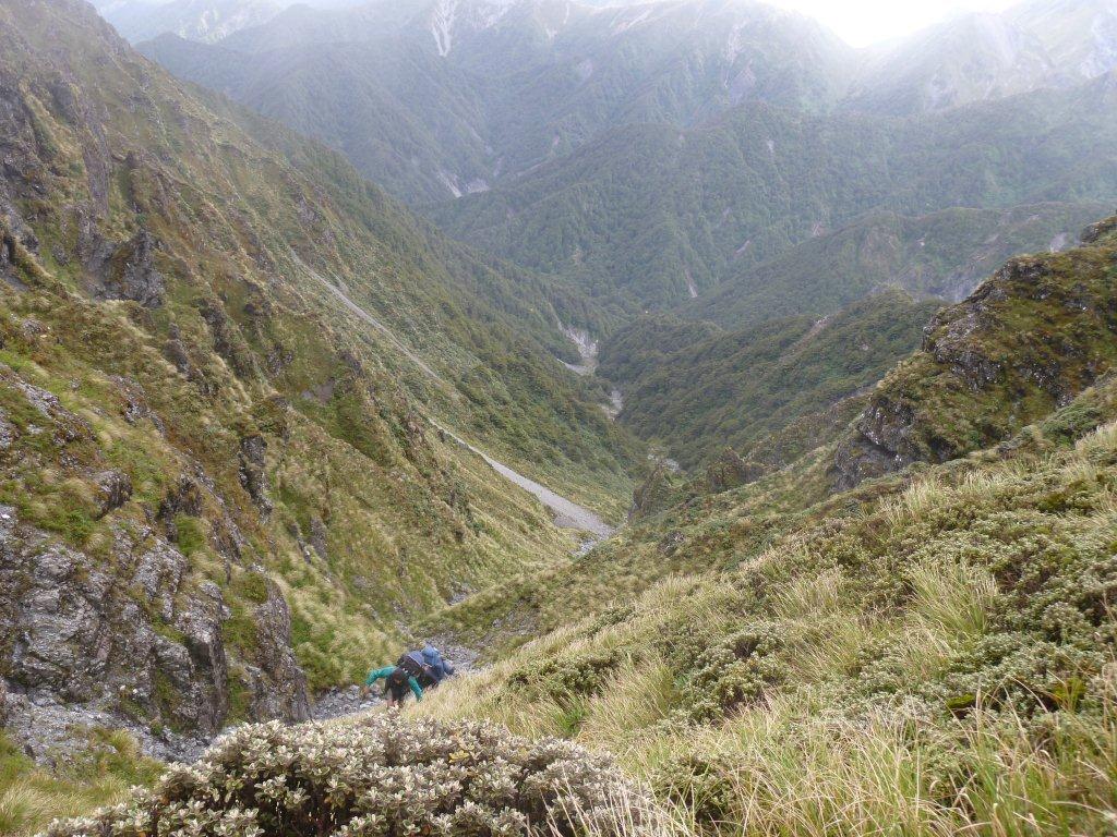
A great Plan B, down the shingle slide
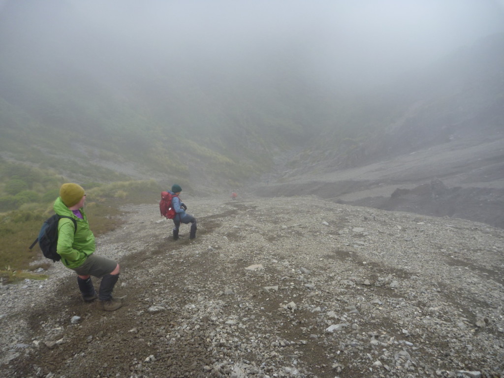
Waipawa River North Arm, Ruahine FP. Saturday February 14, 2015. Map BK36 When we arrived at Sunrise Hut, it was clear that the trip over to Sparrowhawk Bivvy would have to be changed. What was the point in going across the tops when you could not see anything? One look above Sunrise Hut, where we… [Read More]
Like a motorway (they said)
Waikamaka Hut via Waipawa Saddle, Wednesday 21 January 2015 Map: BK36 That’s referring to the track alongside the upper reaches of the Waipawa River. It was cut (or recut) last year and makes such a big difference to the ease and travelling time along those sections of the river. We were probably travelling faster than… [Read More]
Dunking in the Waipawa River
Waipawa Saddle, Saturday February 9 2013. Map: BK36 Warm temperatures and blue skies, a good day for a dunking in the river which, as it happened, a member did, not five minutes from the car park! The low river level had left slippery rocks in places. Otherwise, it was an uneventful wander upstream. The buddleia… [Read More]
Missing trampers were all at home
Ruahine Circuit Thursday January 3 – Sunday January 6 2013 Waipawa River/Saddle, Rangioteatua, Waterfall Hut (Day 1). Pinnacle Stream, Iron Peg, Mangaweka, Hikurangi, Crow Hut (Day 2), Rongotea, Wakelings Hut, Maropea Forks Hut (Day 3), Top Maropea Hut, Armstrong Saddle, Sunrise Hut, North Block Road car park (Day 4) Trampers: Alison Greer, John Dobbs, Geoff… [Read More]
Over the edge and into the unknown
Waipawa River – Waipawa Saddle – Three Johns – Middle Stream, May 5 2012. Map: BK36 Taoroa Junction The perigee moon had just risen as the group of seven crossed the Waipawa River and trudged up the hill to the car park and the welcoming sight of the waiting van, after four hours coming downhill… [Read More]