Tramp List Amendments and Road Closures
Due to the inability to access most of the Ruahine Forest Park and the Kaweka Forest Park, the club is arranging local walks in environs of Napier and Hastings. Go to the tramp registration system for updates.
A post on the Ruahine User Group Facebook on 6 March advises:
Cyclone Gabrielle update from DOC: Good news. Aerial spot checks of huts and structures in the Ruahine Forest Park this week showed no further major damage (other than that reported earlier on Leon Kinvig hut, No Mans Road and Kashmir Road).
Slips were seen on tracks near Ngamoko, Leon Kinvig, Smiths Stream and Hinerua huts.
This means that the Ruahine Forest Park is OPEN. Storm damage is likely so extra caution is required. It would be very helpful if any damage can be reported to manawatu@doc.govt.nz, ideally with photos and GPS.
A number of council roads accessing the forest park are closed, plan accordingly.
NB: Update on Kashmir Road. This is located just before Daphne Road. The contractor is waiting for confirmation that Mill Road is safe for machinery before clearing the slip.
On 9 March: Access to Daphne car park (off Kashmir Road) is now open. Kashmir Road is closed past this point due to further slips, which are yet to be cleared.
On 11 March: Update from DOC, track closures: The tracks between Alice Nash Heritage Lodge and Iron Gate Hut and Iron Gate Hut to Triangle Hut are closed due to large unstable slips. The DOC website will be updated shortly. Signage has been put up at nearby sites.
Click below for the links to local road closures:
Hastings District Council’s area
The Aotearoa Species Classifier App
At a recent club meeting, Di Reid mentioned a new app which identifies plants, animals and birds in New Zealand. But when trying to search and download it, many club members had no success. It turns out that this is because it only works for iPhones and iPads at present – but there is an Android version coming out later this year.
For more information on the app, click here.
Mokai access to Iron Bark and Colenso huts
What follows is copied from the Ruahine User Group (Private) Facebook Page post by Megan Dimonzantos, BCT North Island Mgr (26 January 2023):
IMPORTANT TRACK INFO FOR MOKAI AREA (COLENSO, IRONBARK, OTUKOTA)
The Mokai access to the Ruahine has been successfully reopened. There are some tracks and bridges in there that are not correct on the map, and also some signage stuff to be aware of. Please see attached map and a list below of what each number means.
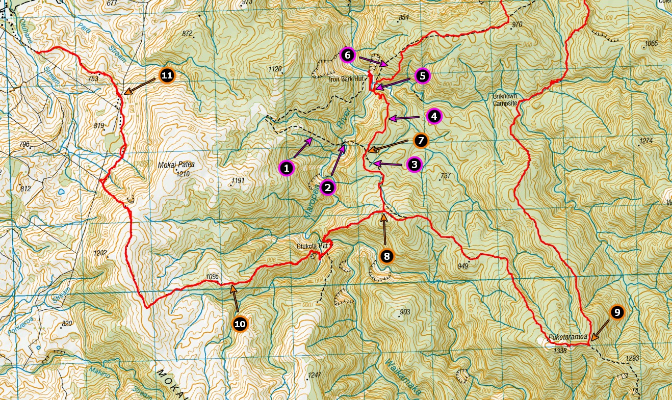
- This track no longer exists
- This bridge no longer exists
- Track requires realignment on maps
- This is a new track, not even marked on the maps. It’s a welcome change, as it saves a lot of time going up and down where track 1 used to be. Much quicker to and from Otukota
- There is a bridge here, not marked on the maps
- This section of track has been realigned and needs changing on the map
- There is a sign at this spot that says the track is no longer maintained and the bridge has been removed. The track it refers to is well and truly covered over now, but it looks like the sign is referring to the new track (4). Ignore the sign. I have asked DOC to remove it.
- The timings on the sign here are seriously screwed up. It took us 35 mins to get from the sign to Otukota hut (the sign says 2 hours) and we weren’t moving that quick (I had an ankle injury). I’ve asked DOC to amend the sign, but the assumption seems to have been carried over into some of the other timings.
- I’ve put this marker in the wrong spot sorry! It should be at the top of Potae! There is a sign here pointing to Waikatore Biv, which is no longer in existence. The sign needs to be changed, but I’d be keen to understand why the biv was removed, actually! Anyone know??? The sign at the Biv site suggests the removal was temporary.
- There is a sign at this point that tells hunters to unload their guns before they move onto the private property. Some muppet has scratched out the letters “un”, so it looks like it says “guns must be loaded”. Obviously, guns must be unloaded to cross the private land.
- The area here is really sparse on markers and the existing markers need a coat of paint to make them visible again. DOC are getting to this, but in the meantime, please use your GPS/phone to ensure you stay on the correct access if you need to.
This has all been submitted to DOC for correction with LINZ, but obviously won’t happen until the next map version is released.
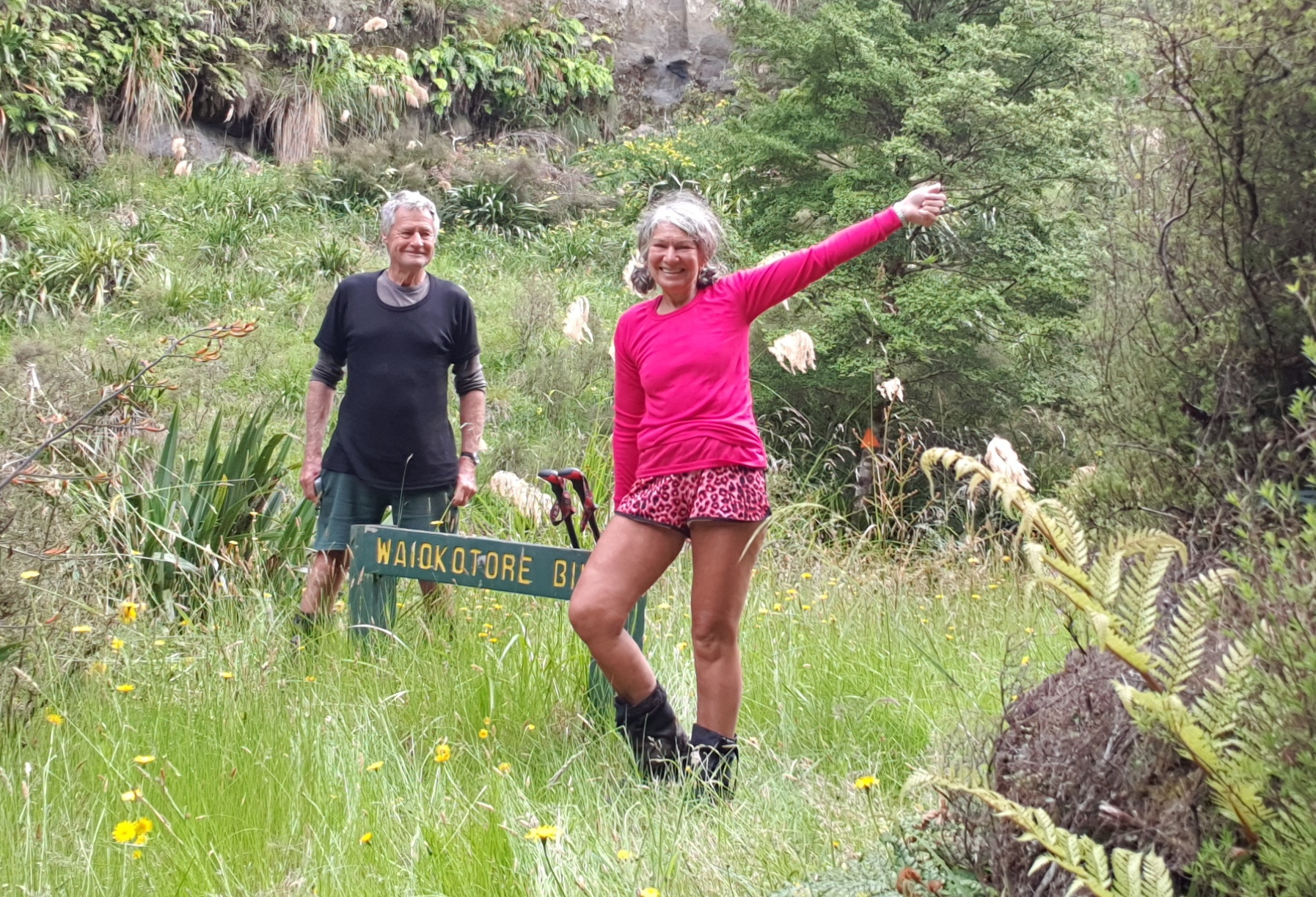
Julia and Les at the Waiokatore Biv site. A good camp spot where the biv used to sit
Tony Quayle responds. Re 9. I don’t recall there ever being a sign for Waiokotore Biv near Puketaramea. At the foot of the track up to Ohutu Ridge maybe.
I believe the Waiokotore Biv was removed due to structural dampness, and you’re correct that it was announced as a temporary removal. I always believed it was DOC’s strategy at the time to just not tell anyone it was permanent…
Colenso to Iron Bark Track A post by David Middleditch (28 January 2023)
To avoid the slip before Colenso hut, we’ve cut a new section of track on the Colenso to Iron Bark hut track. It’s a 5 minute detour and safer than crossing the slip. The new track is signed and marked.
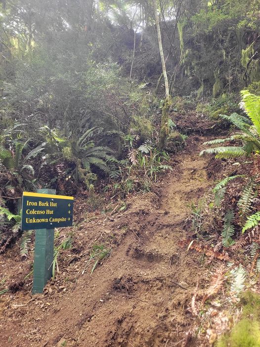
The new track diverting around the slip

Leave a Reply